|
|
|
|

It is amazing what I can fit in the back of my Jeep. Seven days of clothes, a stove, food, pans, firewood, sleeping bag, a tent, 3 inch mattress, a cot, tools, car fluids and so much more. I carefully planned this trip since December as a way to combat the lengthy Montana winter. I pored over maps of the desert southwest, researched parks and campgrounds and studied spring weather patterns and temperatures. I worked extra hard on my book business so a vacation hiatus would not injure my income. I only get paid when I sell books. Paid holidays, health insurance and vacations are for wage earners. I live more precariously and today I set out for the Mexican border.
The day started sunny with a fresh layer of snow covering the hills. It turned grey and gloomy after noon as light spitting snow pelted the windshield. The roads were characteristically empty and I traveled in solitude musing about the long lasting winter and envisioning warm, sunny desert weather. Would I see wildflowers? A friend sent me a link showing the southwest was having it's best bloom season in a decade.
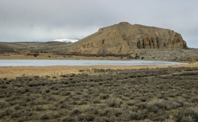
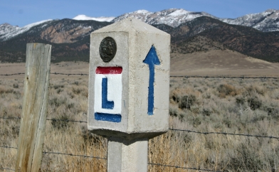
Point of Rocks. First noted by Lewis and Clark in 1805 |

Now called Beaver's Head Ranch and valley |

Montana is a wonderful state but sometimes the scenery is as forbidding as Mongolia. Rolling hills give way to jagged peaks that remain snow covered most of the year. As I sped towards the Idaho state line the snow grew deeper and the elevation higher. Along the right side of the highway graders with massive plows cleared several pathways through the fields. Each cut acted as a catch basin for blowing snow. As soon as one cut was filled another was created. Snow was piled high in 10 foot tall furrows across the winter landscape.
Gold was discovered here on Grasshopper Creek just before the Civil War. A freight trail was created that ran from northern Utah to eventually Helena. Wagons pulled by oxen and weighed down with 10,000 pounds of food and supplies could make the complete journey over the Bannock trail just 3 times between spring thaw and the first winter snow. I-15 follows their trail but the efficiency of travel has greatly improved.
Once I cleared the Idaho state line and came down into the Snake River plain the temperatures warmed to 40 degrees and the snow was noticeably thinner with patches of sagebrush poking through the white, winter blanket. A light rain glazed the highway and traffic visibly increased. Idaho seems to be a busier state than Montana and Utah is even more industrious.
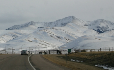
Mongolia or Montana? |

Approaching the Idaho state line |

Slept well at the Motel 6 in Twin Falls, Idaho. But I sleep well almost everywhere.
As I get older I am less willing to embrace new technology. I prefer that it be proven by others who have more time left than I. So it was only last month that I picked up a used Magellan GPS unit at a thrift store for $3.50. Today I typed in my evening destination and asked the machine to guide the way. It immediately took me back over the Snake River which was 180 degrees opposite of where I wanted to go. Making the best use of a serendipitous moment I stopped at the lookout point and was pleasantly surprised by the lovely view. I traveled over this bridge a dozen times before and never bothered to stop. I missed so much.
The river down cut a 500 foot steep walled canyon into the basalt plain. For early settlers this was an almost impenetrable barrier and a frustration to farmers who had no easy way to bring the water below to the fields above. Today life is so much easier and travelers zip across the river in less than a minute.

Old Snake River bridge Looking west up the canyon |

Snake River Canyon 500 feet deep and cut through basalt |
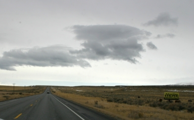
South of Twin Falls on Route 93 |

A nearby basalt butte and distant snow covered mountains |

Iturned the Jeep around and headed back down Route 93 south and was quickly out of town. A nagging but pleasant female voice kept urging me to "make a legal u turn as soon as possible". I shut the GPS unit off and solitude once again enveloped me. Around me the landscape returned to an occasional house surrounded by miles of fields with a few roaming cattle. I was so absorbed in the vastness of the scenery that I forgot the gas tank was almost empty. A bit further down the road an annoying beep alerted me that if I did not find a gas station soon I would be hitchhiking. Not trusting the GPS unit I checked the map and a town was further south. On I drove for what seemed like a long time and then around a corner and over a hill rose a Chevron gas station. Later I learned that human error was the problem with the GPS machine. If I requested a short route instead of the fastest route it might have sent me south on 93.
The road climbs towards the Nevada border and a curious 8 foot high wire fence screens both sides. A little further on two small bridges decorated with hoof prints span the road. Deer migrate here and to reduce the carnage fences were installed and bridges built.

Leaving the Snake River Plain |

Deer bridge across Route 93 in Idaho |

The Great Basin desert begins at Wells, Nevada. The countryside is broken up into north and south trending mountain ranges with large, dry valleys between them. The mountains are mainly limestone for once they were ancient seabeds. As a result the soil is poor quality clay and heavily alkaline. Sagebrush, juniper and a few grasses dot the landscape. Sometimes a lake is at the lowest part of the valley. In the lower and wetter parts of the valley a few ranches still exist.
The land is open, vast and the beauty is dramatic. Snow covered peaks frame the landscape and Route 93 runs the length of several valleys and crosses a few ranges. It is a lovely path to meander on the way to Las Vegas and points beyond.
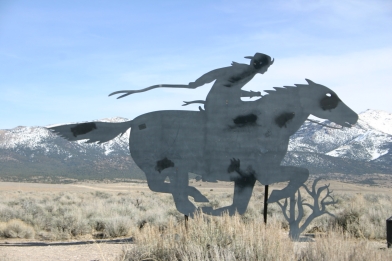
The Pony Express crossed northern Nevada on the way to Sacramento. |
The Lincoln Highway - the first transcontinental federal highway also passed through here. |

Days End - Camping at KOA in Ely, Nevada |
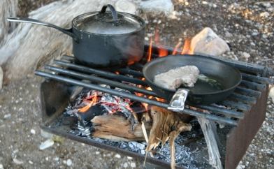
Steak and potatoes over a sagebrush fire |

Just outside of Ely is Ward Charcoal Ovens State Park. That was my first stop after thawing out and wolfing down a warm breakfast of fried eggs, toasted bagel and tea. There was ice on the tent walls and my toes remained frozen for an hour or more. A warm shower after breakfast thawed them and refreshed me. I then worked on this page for two hours and by lunch the temperature outside had climbed to 50 degrees Fahrenheit. Balmy by Montana standards.
The ovens were built to slowly burn wood and turn it into charcoal for a nearby silver mine. The entire operation was soon displaced by the railroad which made coke, a product made from coal, cheaper. Capitalist creative destruction we call it now. Progress dooms one company while opening opportunities for another. The ovens were not used much and thus are remarkably well preserved. The state park also offers camping and about a mile away is a privately owned general store. The view is beautiful and the gravel roads are good.
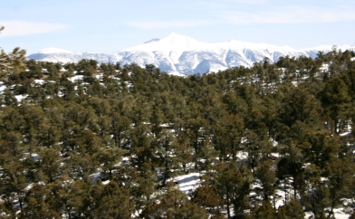
Wheeler Peak - 13,063 feet Great Basin National Park |

Route 50 and Wheeler Peak |

Dozens of unmarked dirt roads lead into the Nevada wilderness |
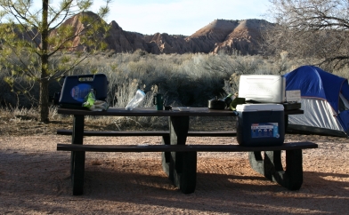
Another wonderful day ends. I camp at Cathedral Gorge State Park in Nevada |

Ice once again coated the inside of my tent and my feet were cold. Determined to warm up I vowed to go hiking right after breakfast. I rose early and heated some tea and toasted a bagel over the propane camp stove. Then, just as a pale and cold sun was breaking over the eastern cliffs I set out on the Juniper Loop trail. My feet were numb but started to tingle. A good sign I thought as an early morning jackrabbit crossed my path.
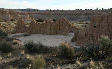
Cathedral Gorge State Park is placed amongst eroding clay, volcanic ash and limestone hills. The reddish orange is mainly Bentonite clay and it easily erodes via water and wind. I followed a desert wash for about a mile along a marked trail. Gradually the wash narrowed and eventually I found myself in small canyons. That was when the sights really started to become interesting.
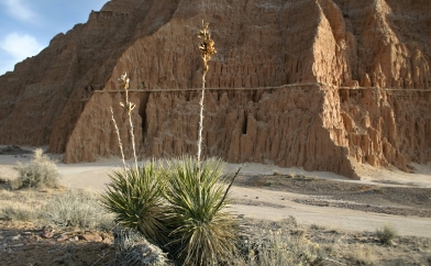
A Yucca plant thrives next to an eroding Bentonite hill |
Big hills rapidly erode to form smaller Bentonite hills |

Note the different layers of rock for both hills. |
Alluvial fans from an eroding gravel and volcanic ash layer. A mini Death Valley sight. |

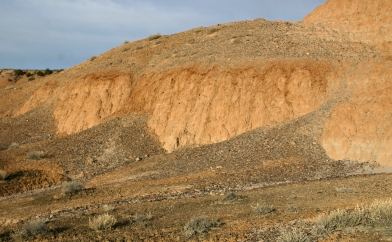
I love a mystery and I really enjoy listening to the landscape. Rocks have a story to tell and these hills and I chatted all morning. The fine layers of sand and clay indicated that a shallow lake was once here. Gradually it filled in with sediments and then during a violent volcanic outburst received a layer of ash and basalt gravel. Over that another lake formed which was also slowly filled in. Eventually ocean waters covered the lake and limestone formed from layers of dead marine life and shells.
Note the grey layer of rock in the upper right hand corner of the photo. That is hard limestone and erodes far more slowly than the soft layers of lake bed clay. Note how vegetation gains a foothold on relatively intact soils just beneath the limestone layer. The clay layers erode too quickly for plants to stay long. The valley floor is covered with eroded clays that recently washed down from the red hills.

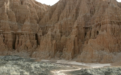
A limestone cap rock layer impedes underlying clay and ash erosion. |

Fertility goddess was here! Hoo-doo is the geological term |

Hoo-Doos are erosional formations that have a hard cap rock and softer layers below. |

A limestone block rests high above ever narrowing canyon washes. |

I climbed almost to the limestone cap layer by simply following ever narrowing washes through the eroded clay hills. I was careful not to walk on the fragile and sun baked desert surface. A new rain will erase my wash footprints but desert surface ones will stay for much longer.
I followed the wash back down and to the other side of the park. There the hills were eroded in a sharper and more gothic looking pattern. I suspect the rain fell almost straight down on the hills here as opposed to running over the limestone cap and slowly eroding away the other side. Few washes intertwined these hills; most of the erosion was almost straight down.

A sharply eroded hill with a small limestone cap above. |
Looks like Notre Dame in Paris? Gothic spires rise towards heaven. |

A chorus of gothic spires near the park picnic area. |
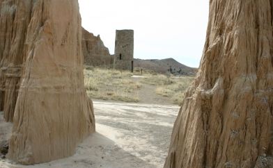
A water tower built by the Civilian Conservation Corps in the 1930's. |
Click on the "Bookmark and Share" button to:
What do you think of this page? How can it be improved? Do you have questions about its content? Share your thoughts with Tim and other readers by clicking on "Leave a message". I read every message and will respond if you have a question.
|
Travel Table of Contents |
Tim's Life Main Table of Contents |

Travel Table of Contents |
Page 2 Las Vegas to Ajo |
|
|